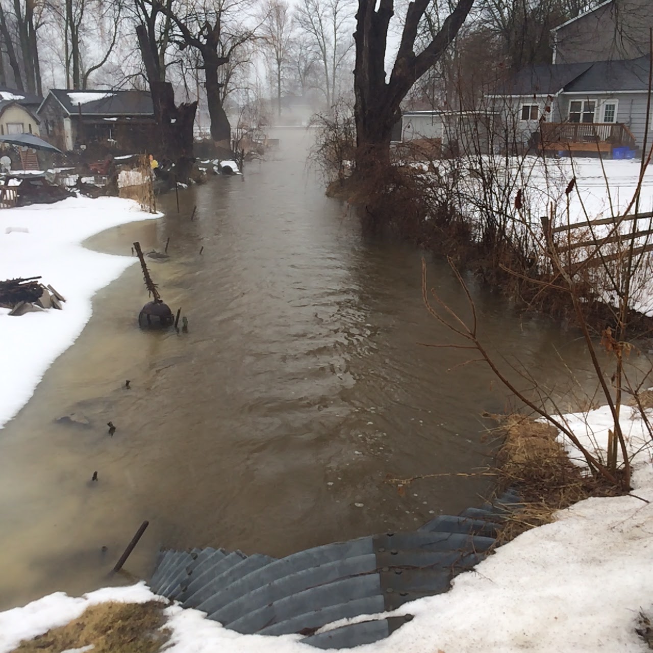
Feb of 2018 the temperatures rose and when rain was added well the creek was max'd out. The creek can not handle the flow of water from HWY 48 and then the field nearby. What happened is the community got flooded. The park next the creek was under a foot of water, houses surrounded by water and lots of damage. Town came out to assist which was great and even the workers said look at the amount of water. But the wetland the farm has is bone dry. You see his farm slowly drained into the wetland on the north part of the farm at one time and the water would be naturally filtered before entering the lake. But these ditches have halted any water from draining into the wetland and then into the lake. I am surprised as you read all about protecting wetlands but here we are drying one up. The resident who has a lakefront house and on his east side is this wetland has show me how years before the water would flow beside his property but no more. Even the town installed a new culvert pipe which went into the wetland as there was that much water. But now it's dry, so is there a plan to dry this up and use it?
Feb 14th we had two people (Lori and Peter) out from LSCRA to see how the beach association could shore up the banks of the creek that is owned by them. The snow was not too deep so we were able to walk the creek and they both saw how all the banks are severely under cut. They said that there is no point shoring up until the source of the problem is solved.
Last year we had 3 residents apply for grants from LSRCA for grants and the work was done with granite boulders. They were very happy the made the decision before this thaw in Feb.


Community park flooded


Resident next to creek trying to save his house as totally surrounded by water


 |
New rock shoreline covered by the flow of water


LSRCA noted that the farmer has been taking out trees along the creek shoreline and asked when. I said just recently and by the roots so it weakens the bank even more.


The following 3 shots show the efforts by residents who live on the creek.


It amazing the impact this has had on the region and the following pictures will show the changes in 5 years since this started.
 |
| 2012 enjoying the lake with pets and grand kids |
 |
| Note the rock shoreline as Beach Association with permits stabilised it to reduce erosion. |
 |
| Not a weed in sight other than Trumpet Grass which is normal. |
 |
| No kids allowed no |
 |
| Park lakefront a mess |
 |
| A shame |
 |
| Boats out early as weed so thick and residents are concerned with what is in the water |
 |
| Big changes |
If you thought the winter freeze up would stop the sedimentation think again. Shown below are pics showing the creek and lake frozen but a slight thaw and the run off travels on top of the ice and out into the lake.


